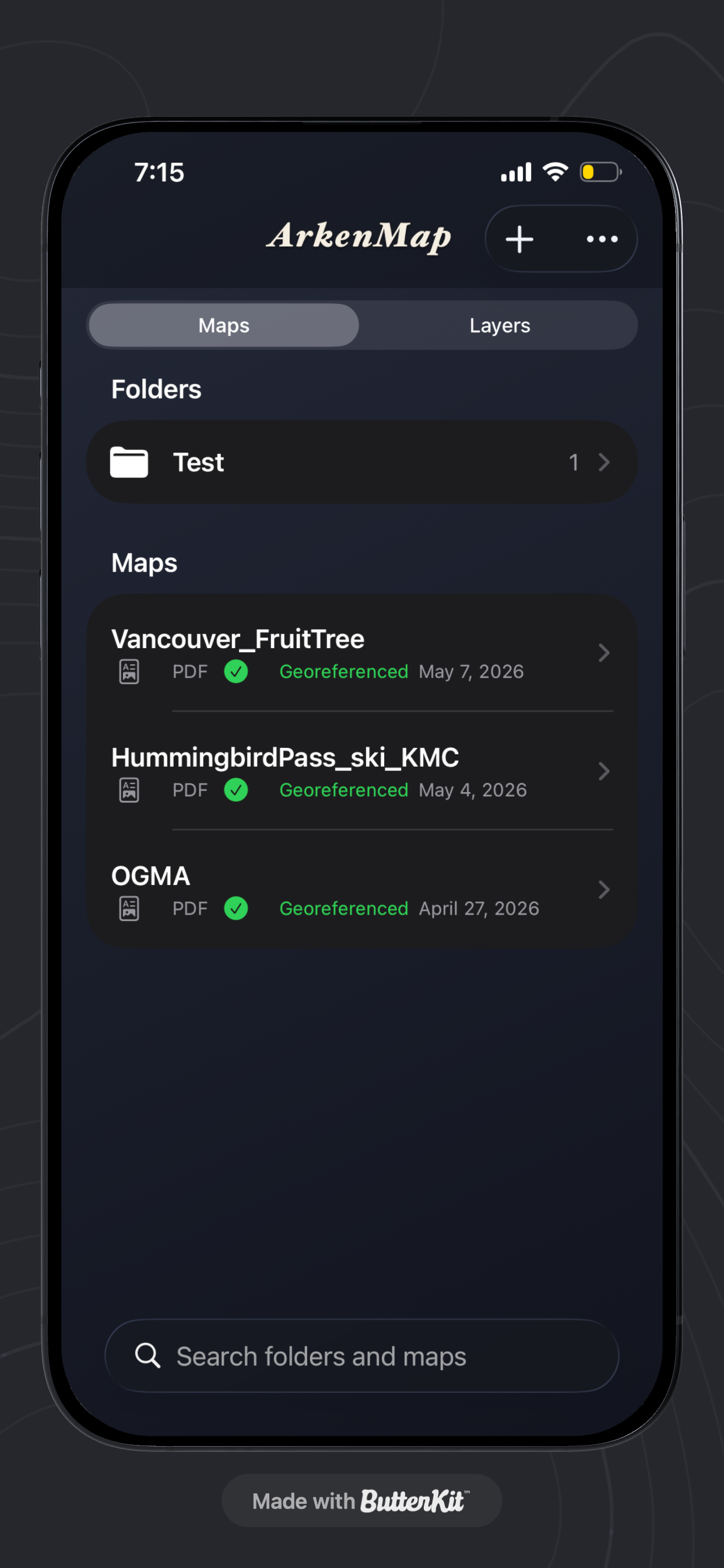


Features & Capabilities
User Growth & Download Statistics
App
- By:
- ALEXANDER THOMAS ROBINSON
- Rating:
- 5.00 (1)

- Version:
- 2.00 Last updated: 2026-07-07
- Version code:
- 887868812
- Creation date:
- 2026-04-26
- Compatible devices:
- Size:
- 7.36MB
- URLs:
- Privacy policy
- Full description:
- See detailed description
- Source:
- Apple Apps Store
- Data ingested on:
- 2026-07-12
- Compare stats and ranking:
-
For Developers
Contact the developer
Chrome-Stats does not own this Apple app. Please use these information below to contact the Apple app developer.
User Reviews
In a world of tech villains there’s a man who has decided to be the tech hero. Finally a simple, straightforward GIS app that doesn’t want to suck you dry of your dollars all so some losers can live in their expensive city with their expensive lifestyles while contributing almost nothing to society other being a gutless leach.
by Sl*****, 2026-06-18
Best ArkenMap Alternatives
Here are some Apple apps that are similar to ArkenMap:

OFF-GRID
Cross Works
0.00  (0)
(0)

Paper Maps
Abbro Inc
3.90 (13)

CartoGraphix
Shaun Brocklehurst
5.00 (4)

Cartograph Maps 3
Harald Meyer
4.30 (3)

CarryMap
XTools Pro, Inc
4.60 (189)

Avenza Maps: Offline Mapping
Avenza Systems Inc.
4.80 (126,450)

Memory-Map
Memory-Map
4.50 (52)

Land Nav
Gerry Shaw
5.00 (3)

Cartograph 2 Lite Map Viewer
Harald Meyer
1.80 (5)
Geographica | offline map
keiji matsumoto
5.00 (4)

Memory-Map for All
Memory-Map
0.00 (0)

CPW Mobile PDF
State of Colorado Governor's Office of Information Technology
3.00 (2)