


Features & Capabilities
User Growth & Download Statistics
App
- By:
- ePi Rational, Inc.
- Rating:
- 3.70 (3)

- Version:
- 2.352.46 Last updated: 2017-06-21
- Version code:
- 841555783
- Creation date:
- 2016-01-29
- Compatible devices:
- Size:
- 52.75MB
- URLs:
- Website ,Privacy policy
- Full description:
- See detailed description
- Source:
- Apple Apps Store
- Data ingested on:
- 2026-06-10
- Compare stats and ranking:
- San Diego Hikes vs San Diego City Golf
- San Diego Hikes vs San Diego Guide and Subway map
- San Diego Hikes vs San Diego Map and Walks
For Developers
Contact the developer
Chrome-Stats does not own this Apple app. Please use these information below to contact the Apple app developer.
User Reviews
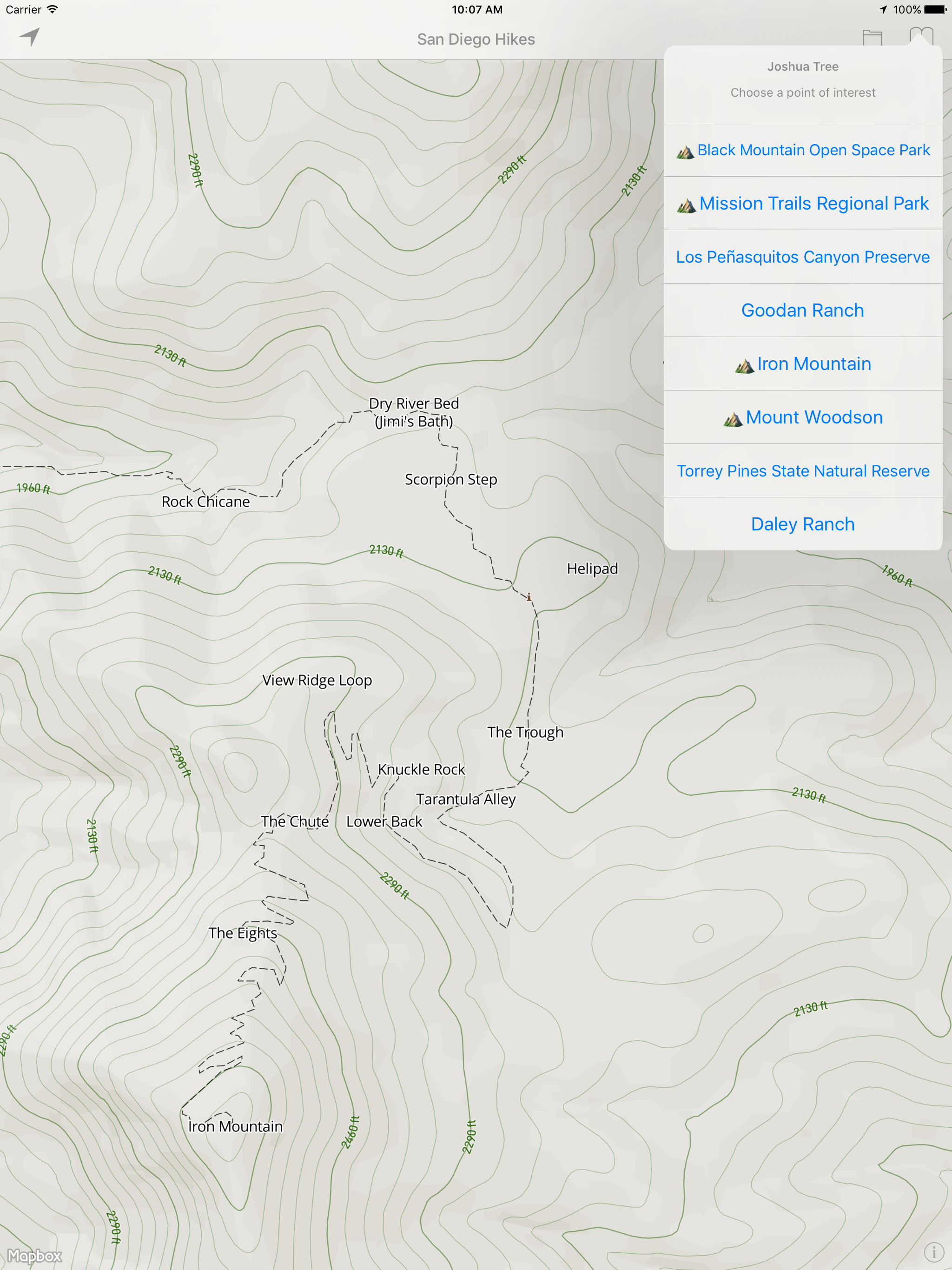
I've used the San Diego Hikes app on three hikes over the last three weeks: Mount Woodson to see Potato Chip Rock, Cowles Mountain using the Mesa trail (backside - east side - of the mountain), and Lake Murray.
It is an excellent app for the casual San Diego hiker. I knew where we were at all times on the Mount Woodson hike. It was our first time doing the hike, and I did not want to wander off on the wrong trail.
A neat feature for Mission Trails is the park map is available in addition to the topo. The Black Mountain park map is another overlay option under the file folder icon.
Lake Murray was more of a walk than a hike, but having the app was useful to answer the "when we will be at the end" question that tends to arise with my hiking partner.
For free, this is a must have app on your phone if you are exploring the many hiking options in San Diego. The maps are always on your phone, useful for the cell-free areas you run into on hikes. Thank you to the developer for making it available.
by To*****, 2020-11-03
iPad version doesn’t work in landscape mode among other problems.
by Ky*****, 2020-04-25
Best San Diego Hikes Alternatives
Here are some Apple apps that are similar to San Diego Hikes:

San Diego City Golf
City of San Diego
3.50  (32)
(32)

San Diego Guide and Subway map
Yaroslav Mykolaienko
0.00 (0)

San Diego Map and Walks
GPSmyCity.com, Inc.
1.00 (1)

Discover SD - San Diego
The San Diego Union-Tribune
4.40 (7)

San Diego Travel by TripBucket
TripBucket Inc.
4.80 (31)
Trails LA County
Trailhead Labs
4.70 (133)

San Mateo County Parks
San Mateo County
3.00 (2)

Finding San Diego
Scavego Interactive Games, Inc.
0.00 (0)

San Diego Subway Map
Yaroslav Mykolaienko
0.00 (0)

Hiking Project
Adventure Projects Inc.
4.50 (1,972)
California Pocket Maps
Alex Gugel
4.50 (106)

Passport to San Diego
Wehaa
3.00 (2)