Real-Time Road Closure Alerts
ResponderMap - Real-Time Road Closure Mapping & notifications for municipalities & Citizens!
Our Mission:
ResponderMap is dedicated to enhancing the efficiency of First Responders, improving response times, and increasing public safety through real-time updates on road closures and hazards. Our app connects emergency services with citizens, ensuring information is accessible and actionable.
Why ResponderMap?
I created ResponderMap after seeing a critical need for real-time road and hazard information while responding to emergency calls. I have been in the fire service since 2010, working through many natural disasters and severe weather events in the Pacific Northwest.
During these events, I noticed a significant communication deficiency when operating with multiple agencies and departments. Information about which roads were recently opened and which roads were still closed was extremely hard to track in real time. Many times, we thought a road was open, only to realize it was still closed while responding to a call. Other times, we took a longer route to avoid a closure, not realizing the road had actually reopened. In both cases, this resulted in longer response times and delays in service.
This isn't the fault of any particular agency or department—it's a breakdown in the communication process itself. During severe events, dozens of calls are generating simultaneously, and radio traffic is at its highest, even with diligent attempts to minimize radio chatter. Notifications about road status simply get lost in the noise.
The Solution:
I created ResponderMap so that communication between any number of agencies or departments could be accurate, instant, and easy to share. If you have a smartphone, tablet, or desktop, you can stay instantly connected to the most accurate and up-to-date road closure information possible.
For Municipalities & First Responders:
*Create and manage road closures in real-time
*Share information instantly across departments
*Receive push notifications when closures are created or reopened
*Coordinate with mutual aid partners seamlessly
*Access the same information whether you're Fire, EMS, Police, Dispatch, Maintenance, Parks, or City Government
For Citizens:
*Follow your city or municipality
*Receive instant notifications about road closures and hazards in your area
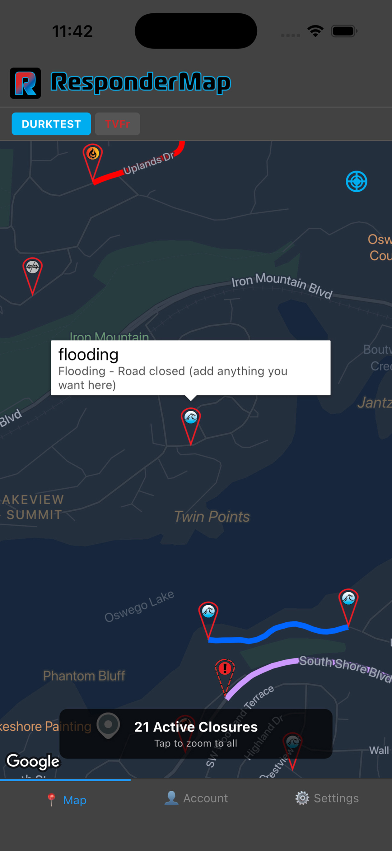
*View an interactive map of all active closures
*Plan your route with accurate, real-time information
Key Features:
*Real-time road closure mapping with GPS precision
*Instant push notifications for new closures and reopenings
*Multiple closure types: accidents, construction, flooding, fallen trees, and more
*Mutual aid partnerships between agencies
*Dark mode support
*Works on phones and tablets
Our Vision:
My hope is to bring all city departments—Fire & EMS, Police, Dispatch, Maintenance, Parks, and City Government—onto the same page during severe weather events, natural disasters, or any event that closes roads or presents hazards to the community. When everyone has access to the same accurate information, response times improve, and communities are safer. Download ResponderMap today and help us improve emergency response in your community.
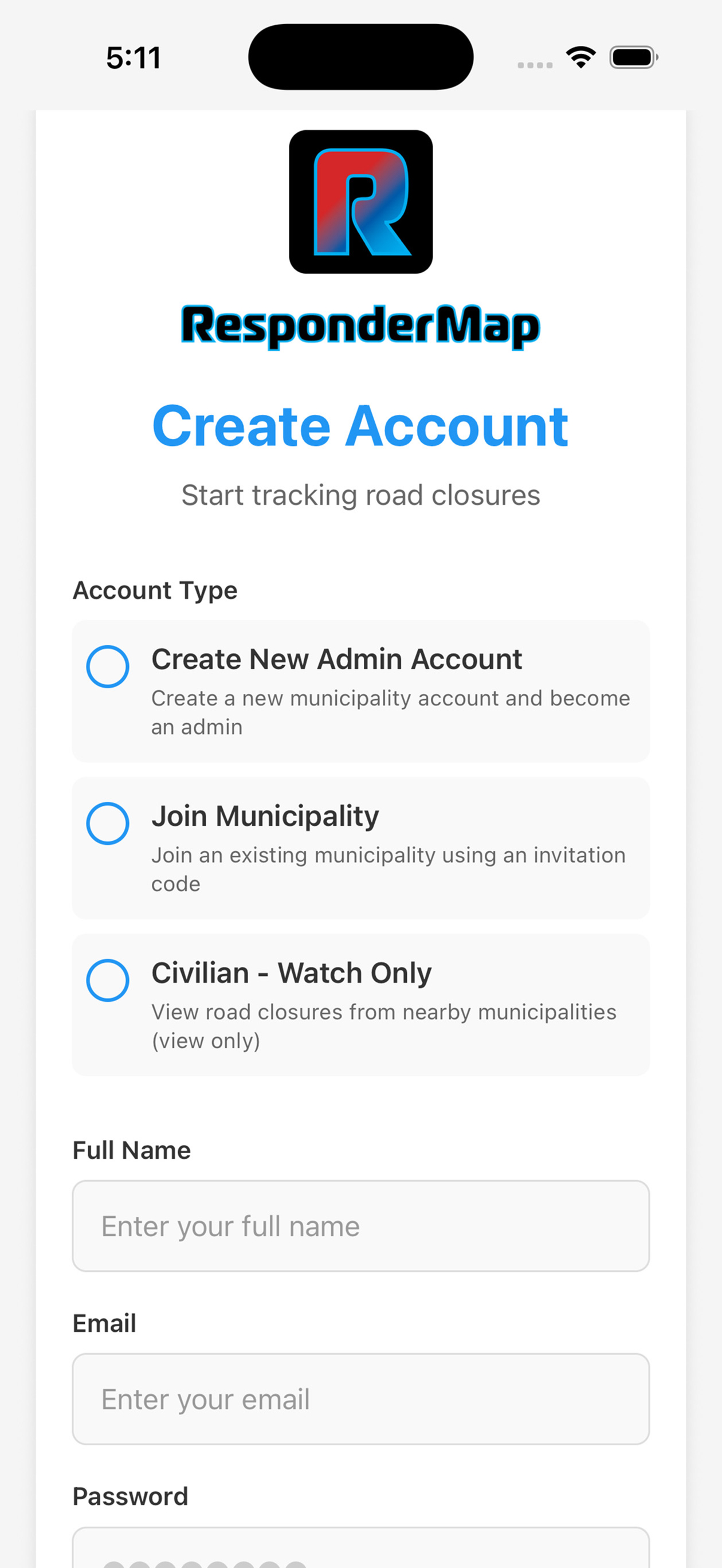
Getting Started:
Download the app for FREE and start your FREE trial! No payment information needed to create an account!
Subscribe in App or Visit our website to create/manage your account. Subscriptions are required.
Visit https://respondermap.com
Terms of service - https://app.termly.io/policy-viewer/policy.html?policyUUID=3ebad7b3-e5c4-43ed-8ce7-2006f0ba071f
Privacy Policy- https://app.termly.io/policy-viewer/policy.html?policyUUID=d31ec587-3baf-484d-b6b5-421e978eb3b0
Chrome-Stats does not own this Apple app. Please use these information below to contact the Apple app developer.


 (0)
(0)