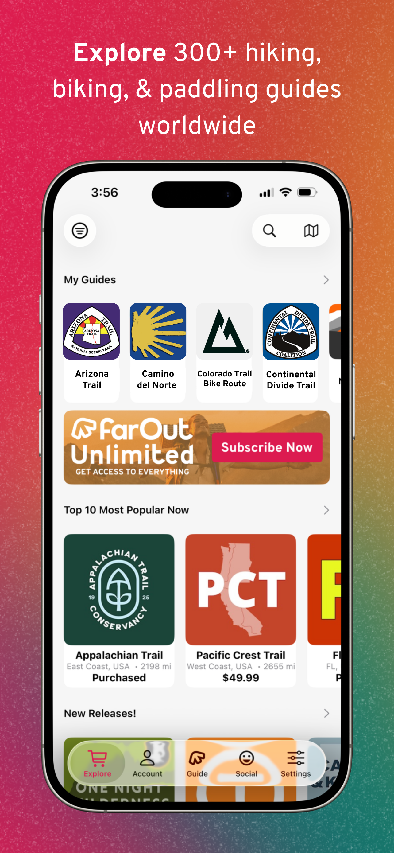


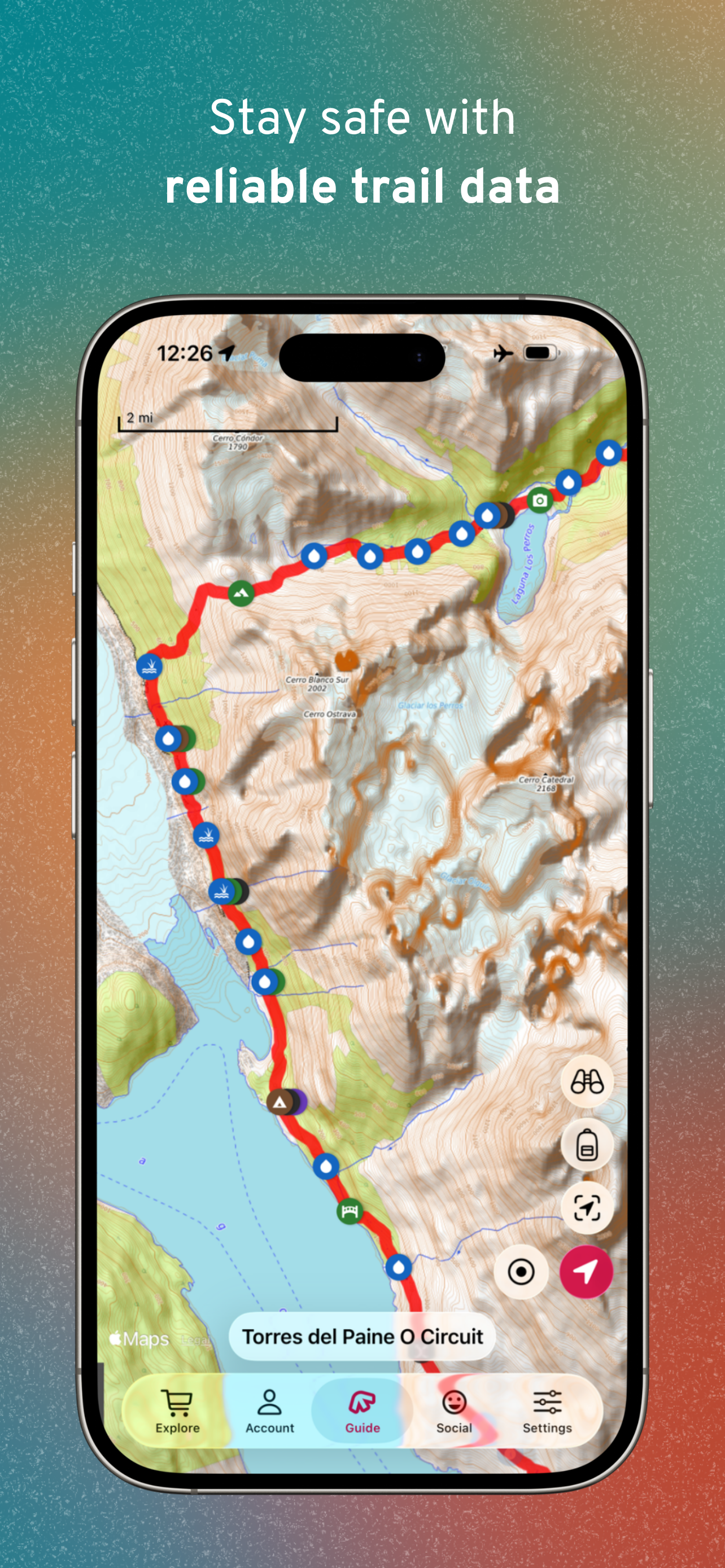


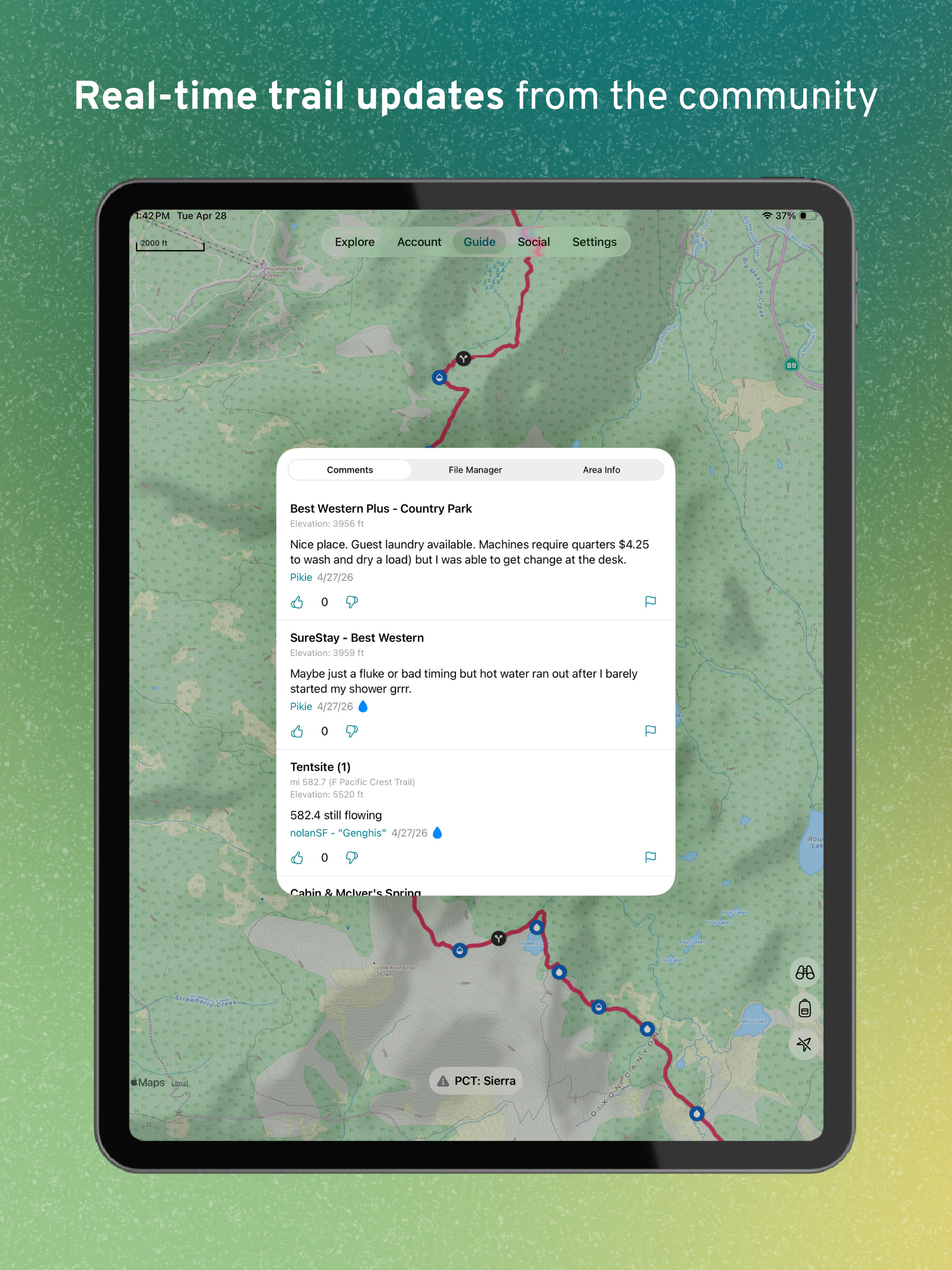
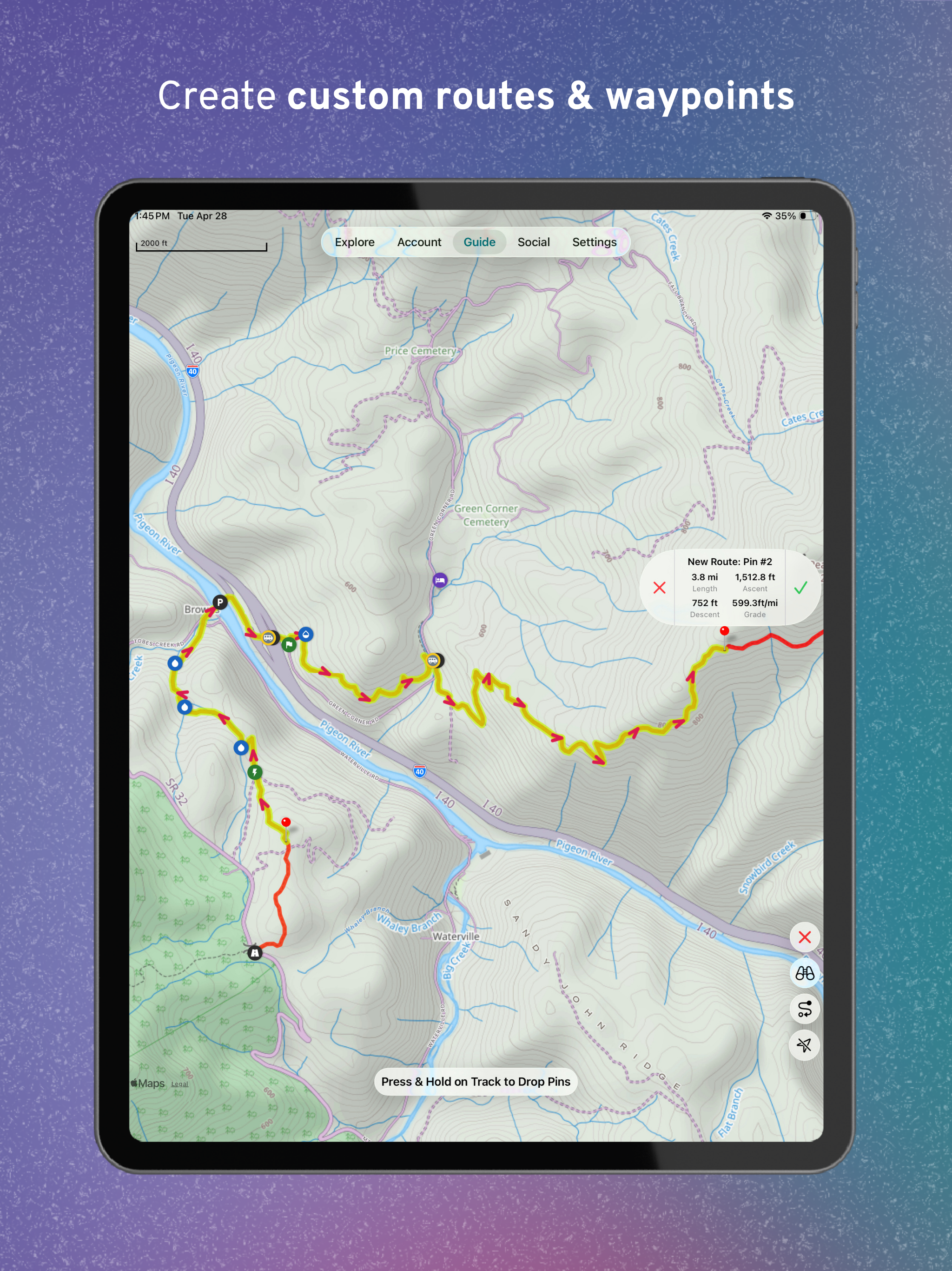
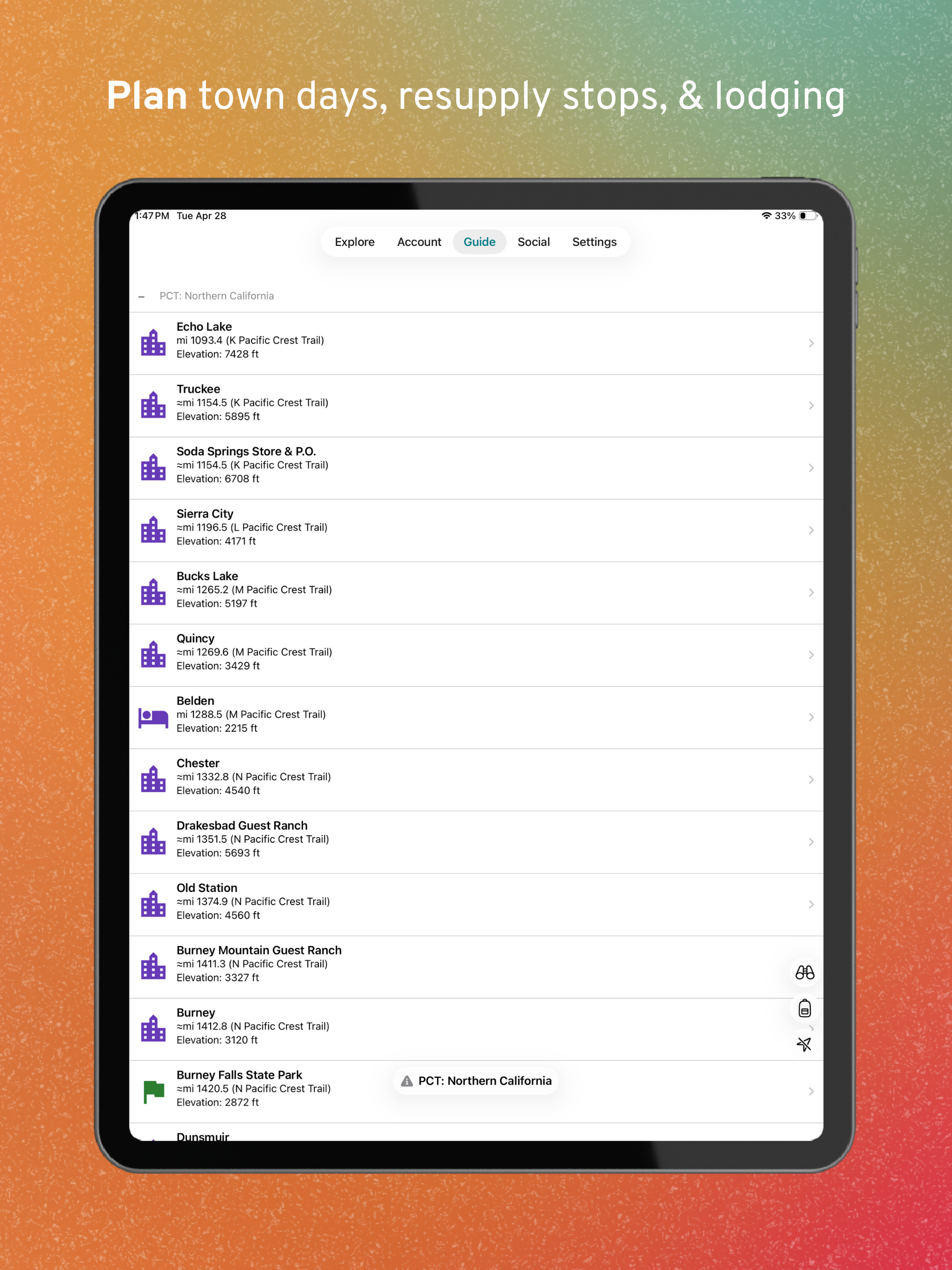


Features & Capabilities
User Growth & Download Statistics
- By:
- Atlas Guides DE, Inc.
- Rating:
- 4.80 (26,144)
 58 new ratings
 - Version:
- 15.2 Last updated: 2026-05-04
- Version code:
- 885135396
- Creation date:
- 2013-03-08
- Compatible devices:
- Size:
- 185.84MB
- URLs:
- Website ,Privacy policy
- Full description:
- See detailed description
- Source:
- Apple Apps Store
- Data ingested on:
- 2026-07-03
- Compare stats and ranking:
- FarOut: Hike, Bike, Paddle vs Trails Offroad: Offline Maps
- FarOut: Hike, Bike, Paddle vs OutDoors GPS – Offline OS Maps
- FarOut: Hike, Bike, Paddle vs Outly
For Developers
Contact the developer
Chrome-Stats does not own this Apple app. Please use these information below to contact the Apple app developer.
User Reviews
Thruhiker logistics get easier
by Sc*****, 2026-06-22
Adding the Great Smoky Mountains maps has helped my son and I start exploring the GSMNP.
I’d like to see one for the Art Loeb Trail.
by CP*****, 2026-06-21
I hope this review answers some questions I wish I knew. I had to purchase one month subscription to get answers. The customer service for this app sucks, there is no contact phone number, only email and I never did get a response, which is why I rate it 3 stars.
I mostly hike/backpack in Washington State. I purchased the PCT section for WA. The information available for campsites, water sources and current trail conditions is invaluable for trip planning. However, you cannot deviate from the PCT trail when entering trip segments. For instance, if you wanted to go camp at Waptus Lake, and then continue to Spectacle Lake via Pete Lake, it will not let you drop waypoints along this route. Buying a subscription does not “unlock” more trails so you could enter waypoints along this route, you are restricted to only the PCT.
In my opinion, if you want trail information for specific trails, just purchase that section. For WA state, there are very few trails available, mostly the PCT and some short hikes in the SE portion of the Olympics. I cancelled my monthly subscription after one week of disappoint, and will only purchase the trail sections I need, which gives you lifetime access. If you are doing any of the PCT, this is the best app for information. For all your local hikes/backpacking, use the
by B *****, 2026-06-08
Best FarOut: Hike, Bike, Paddle Alternatives
Here are some Apple apps that are similar to FarOut: Hike, Bike, Paddle:
Trails Offroad: Offline Maps
TRAILS OFFROAD LLC
4.70  (936)
(936)

OutDoors GPS – Offline OS Maps
RoadTour LLC
4.60 (58)

Outly
Outly
4.70 (1,036)

onX Backcountry: Trail GPS App
onXmaps, Inc.
4.80 (5,939)

Outdooractive
Outdooractive AG
4.30 (431)

Outmap: Ski & Snowboard Maps
Felix Gourdeau
4.30 (43)

Outlandish: Offroad & Explore
Get Outlandish, LLC
4.10 (7)

OS Maps: Walk, Hike, Run, Bike
Ordnance Survey
4.70 (426)

Freemap
BIGWARE, spol. s r.o.
0.00 (0)
Hikingbook: Hike, Bike & Run
Hikingbook Inc.
4.40 (50)

Off-Road Charts
Red Sky Engineering, LLC
0.00 (0)

TrailPass: All Trails GPS Gaia
Polus Apps
5.00 (6)