Measure land, fields & farms
GPS Area Calculator – Measure Land, Fields, Farms & Property with AreaMap
AreaMap is a powerful GPS Area Calculator and Land Measurement app that helps you accurately measure land area, farm fields, plots, property boundaries, distances and perimeters using GPS and satellite maps.
Whether you are a farmer, land surveyor, real estate professional, contractor, engineer, architect or property owner, AreaMap provides fast and reliable land measurement tools directly from your phone.
MEASURE LAND WITH GPS
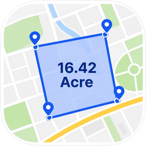
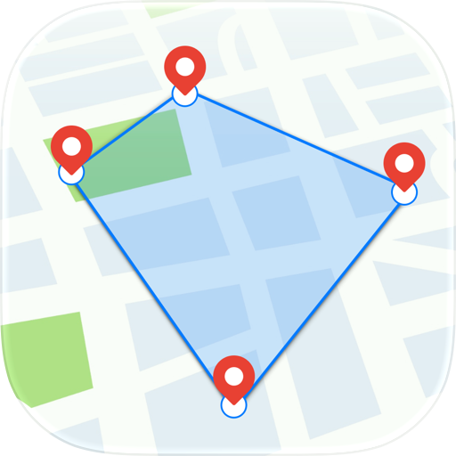
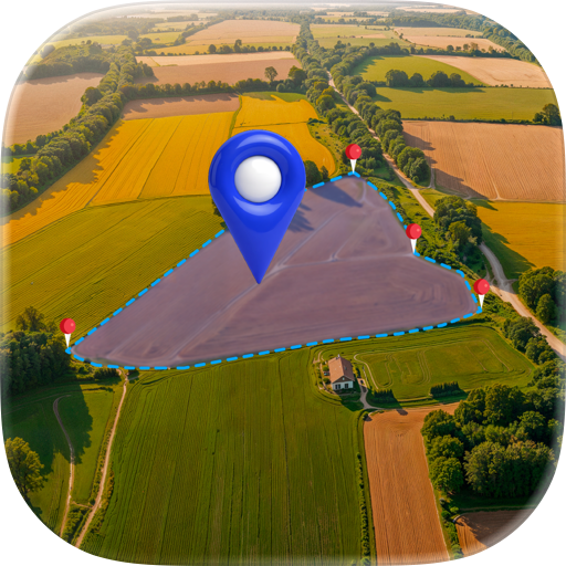
Measuring land has never been easier. Simply place points on the map to draw boundaries or walk around the perimeter using GPS tracking. AreaMap instantly calculates:
• Land Area
• Farm Area
• Field Area
• Plot Area
• Property Area
• Distance
• Perimeter
• Boundary Length
Use AreaMap to measure agricultural land, residential plots, commercial properties, construction sites, gardens, parks and open spaces with confidence.
GPS AREA CALCULATOR FEATURES
• Accurate GPS Area Measurement
• Land Area Calculator
• Distance Measurement Tool
• Perimeter Calculator
• Satellite Map Measurement
• Standard Map Measurement
• Multi-Zone Projects
• Multiple Plot Measurement
• Color-Coded Areas
• GPS Walk-and-Measure Mode
• Built-In Unit Converter
• Save Unlimited Measurements
• Rename and Organize Projects
• Fast Place Search
• Address Search
• Measurement History
• Offline Support
EXPORT PROFESSIONAL REPORTS
AreaMap makes it easy to save and share your measurements.
Export measurements in professional formats:
• PDF Export
• KML Export
• GeoJSON Export
Share reports with clients, colleagues, landowners, contractors and survey teams instantly.
SUPPORTED AREA UNITS
Measure land using popular local and international units:
• Acre
• Hectare
• Square Meter
• Square Kilometer
• Square Foot
• Square Yard
• Bigha
• Guntha
• Cent
• Ground
• And More
SUPPORTED DISTANCE UNITS
• Meter
• Kilometer
• Foot
• Yard
• Mile
100% AD-FREE EXPERIENCE
Unlike many GPS area measurement apps, AreaMap is completely ad-free.
No interruptions.
No pop-ups.
No distracting advertisements.
Focus entirely on measuring your land and completing your work efficiently.
NO LOGIN REQUIRED
Start measuring immediately.
No account required.
No registration process.
No unnecessary setup.
Install AreaMap and begin measuring land within seconds.
WORKS OFFLINE
AreaMap continues working after maps are loaded, making it ideal for locations with limited internet connectivity.
Perfect for:
• Farms
• Rural Areas
• Agricultural Fields
• Construction Sites
• Remote Locations
• Survey Projects
BUILT FOR PROFESSIONALS
AreaMap is trusted by:
• Farmers
• Agricultural Consultants
• Land Surveyors
• Real Estate Agents
• Property Owners
• Civil Engineers
• Contractors
• Architects
• Landscapers
• Government Field Teams
WHY CHOOSE AREAMAP?
AreaMap combines GPS area measurement, land measurement, distance calculation, offline support, professional export tools and local area units in a simple and easy-to-use application.
With support for Bigha, Guntha, Cent, Ground, Acre and Hectare, AreaMap is suitable for users around the world.
Whether you need to calculate farm area, measure land boundaries, estimate property size, map agricultural fields or measure distances on satellite maps, AreaMap provides accurate results quickly and reliably.
Download AreaMap - GPS Area Calculator today and measure land area, perimeter and distance with confidence.
Chrome-Stats does not own this Apple app. Please use these information below to contact the Apple app developer.


 (0)
(0)