High Country Outdoors gives hikers, mountain bikers, trail runners, paddlers, anglers, skiers, and equestrians real-time outdoor conditions for the mountains of Western North Carolina, Eastern Tennessee, and Southwest Virginia — before you leave the driveway.
TRAIL CONDITIONS
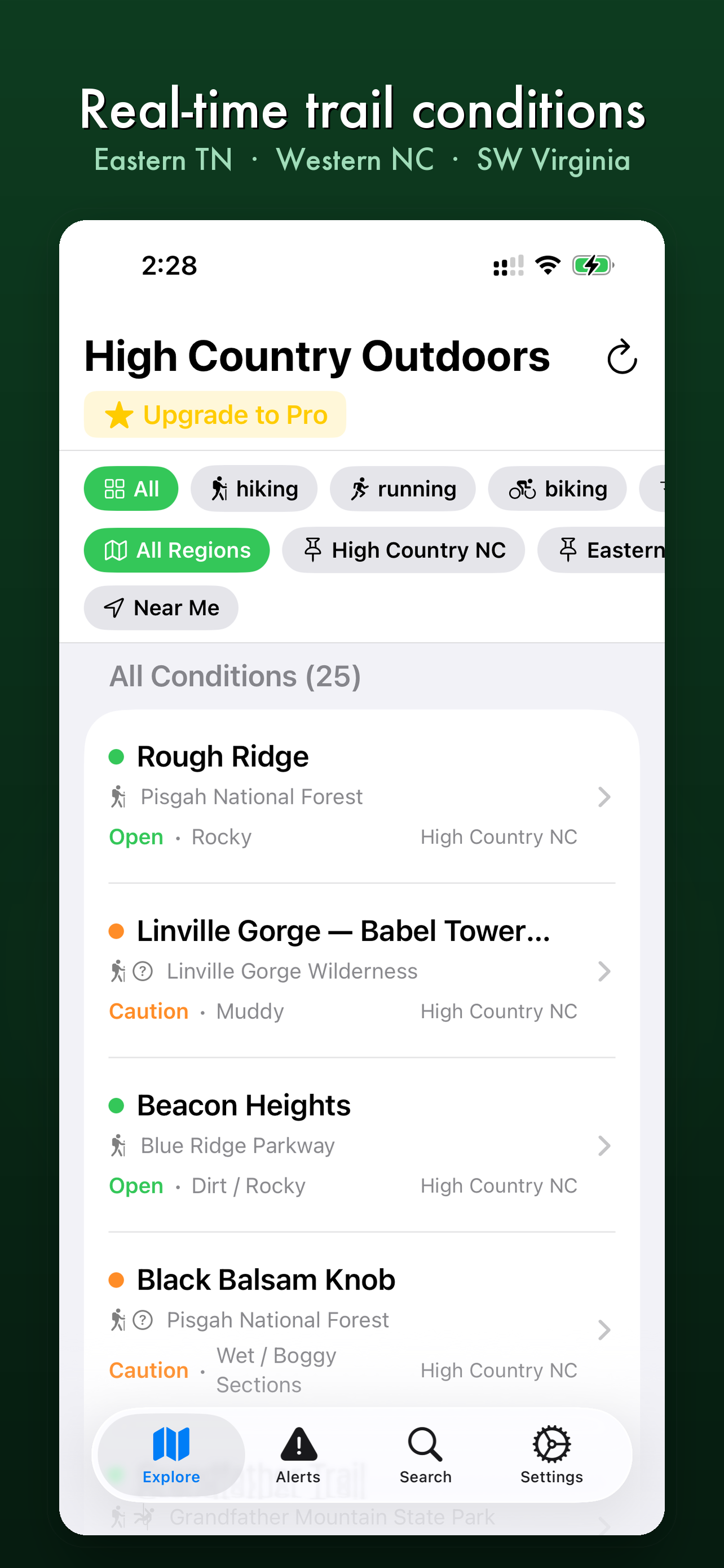
• Live trail conditions — open, caution, or closed — updated daily
• Surface conditions, water crossings, blowdowns, snow levels, and air quality
• Active alerts for closures, fire, flooding, and bear activity
• Filter by activity: hiking, running, biking, climbing, horseback riding, and more
• Filter by region: High Country NC, Eastern TN, or SW Virginia
• Full trail details: length, elevation gain, difficulty, and park information
SKI CONDITIONS
• Real-time conditions for Sugar Mountain, Beech Mountain, and Appalachian Ski Mountain
• Base depth, new snowfall, open trails and lifts, and surface conditions
• Resort status updated daily throughout the season
RIVER CONDITIONS
• Live river flow data from USGS gauges, updated every 15 minutes
• Current CFS, gauge height, and rising/falling trend for High Country rivers
• Color-coded conditions: Low, Optimal, High, and Flood
• Essential for kayakers, tubers, and rafters before every trip
FISHING CONDITIONS
• Browse the best trout streams, trophy fisheries, bass rivers, and wild trout waters in the region
• Species info, best seasons, wild vs. stocked status, and access details for every spot
• Live water temperature and flow conditions where available
• Regulations and license requirements so you're always fishing legal
• Access point maps so you know exactly where to park and put in
• Filter by Trout, Bass, Wild, or Stocked waters
NEAR ME
• Sort trails and fishing spots by distance from your current location
• Perfect for tourists staying in the mountains
HIGH COUNTRY OUTDOORS PRO
• Get Directions — one tap to navigate to any trailhead, put-in, or fishing access point
• Full fishing spot details including regulations, maps, and live conditions
• Advanced fishing filters: Bass, Wild, and Stocked waters
• Live fishing temperature guide — know if the bite is on before you rig up
• Priority trail alerts and push notifications for condition changes
• Trailhead weather — forecast at the exact trailhead, not just the nearest city
• Offline conditions — cache data before you lose cell signal
BUILT FOR THE MOUNTAINS
Covering the Blue Ridge Parkway, Pisgah National Forest, Cherokee National Forest, Nantahala National Forest, Linville Gorge, Roan Mountain, Mount Rogers, and dozens more destinations across the Southern Appalachians.
Whether you call the mountains home and hit the trails every weekend or you're just visiting, High Country Outdoors tells you exactly where you can go — and what to expect when you get there.
https://www.apple.com/legal/internet-services/itunes/dev/stdeula/
Chrome-Stats does not own this Apple app. Please use these information below to contact the Apple app developer.


 (1)
(1)