Mountain Maps: Hiking Apple

Mountain Maps: Hiking

Mountain trails, route planner

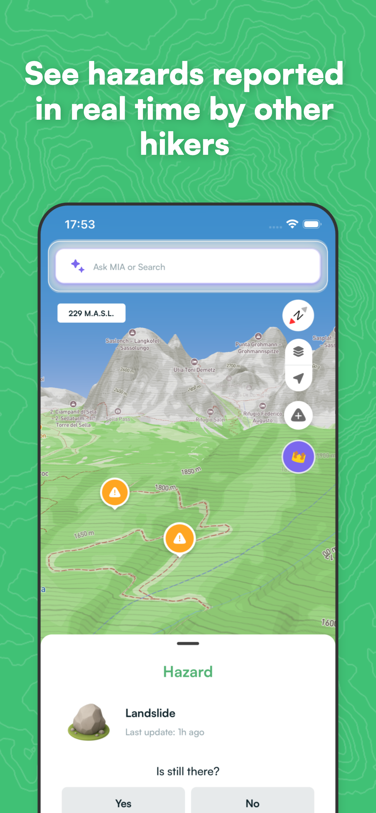
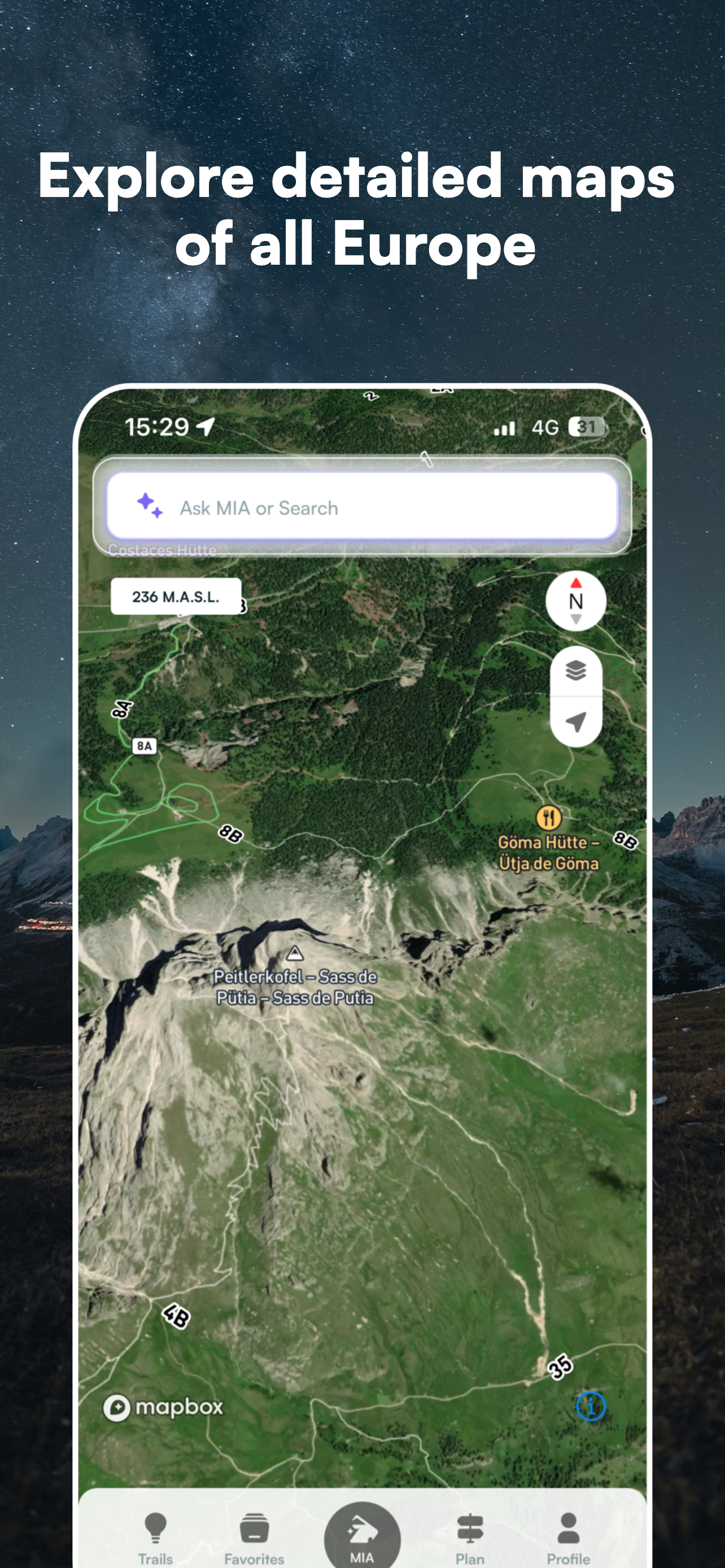
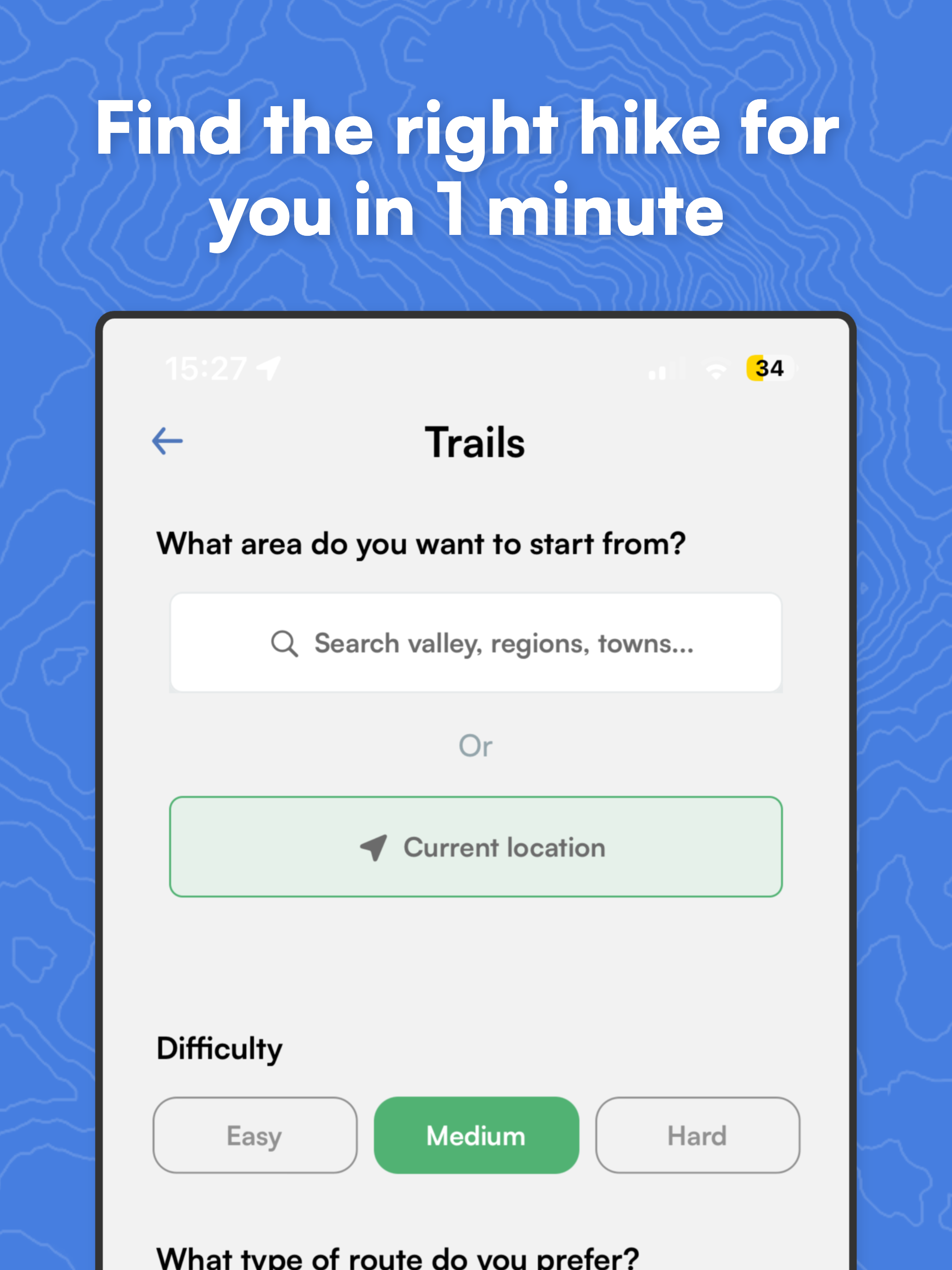
Features & Capabilities

Mountain Maps is the app for safe mountain trekking, all year round.

Mountain Maps is the app for exploring the mountains safely, in every season.

Designed for people who love hiking in the mountains, it helps you discover, plan, navigate and analyse every route with detailed information about terrain, slope and trail conditions.

—————— WHAT YOU CAN DO WITH MOUNTAIN MAPS ——————

Can I choose a destination and get a suggested trail? Yes. Just choose where you want to go — a lake, mountain hut or summit — and Mountain Maps will instantly suggest the best route.

Can I check for hazards along the trail? Yes, in real time. With the Trail Hazards feature, you can see reports shared by other hikers, including obstacles, landslides, exposed sections and closed trails. And if you encounter something yourself, you can warn other hikers in just a few taps.

Can I plan a hiking route from point A to point B? Yes. You can create a complete itinerary with: • Start and end points • Intermediate waypoints • “Avoid via ferratas” filter • Detailed analysis of elevation gain, slope and terrain type

Can I find new hikes suited to my level? Yes. You are not limited to routes created by other users: Artificial Intelligence creates a personalised itinerary for you.

Does the app work offline? Yes, completely. You can download offline maps for all of Europe, navigate without mobile coverage and use GPS even in remote areas.

What about during the winter season? Mountain Maps supports you all year round: plan routes on ski slopes, view lifts and pistes, use the “Avoid black slopes” filter and check snow conditions and gradients.

—————— GPS NAVIGATION FOR THE MOUNTAINS

Turn your smartphone into a professional hiking GPS: • Real-time GPS position • Navigation along planned routes • Save routes and favourite locations

—————— DETAILED TOPOGRAPHIC MAPS OF ALL EUROPE Access advanced mapping features including: • Contour lines • 3D terrain visualisation • Slope and snow layers • Free offline maps

—————— GPX FILE SUPPORT Have a GPX track? With Mountain Maps you can import GPX files, export routes and sync with GPS devices such as Garmin.

Download Mountain Maps now and turn every mountain adventure into a safer and more complete experience.

Terms of Use: https://www.apple.com/legal/internet-services/itunes/dev/stdeula/ This app uses background location even when the app is not open to allow the user to use navigation.

User Growth & Download Statistics

App
By:
MountainMaps SRL
Version:
5.9.1 Last updated: 2026-06-04
Version code:
886472801
Creation date:
2024-10-31
Compatible devices:
Size:
205.63MB
URLs:
Website ,Privacy policy
Full description:
See detailed description
Source:
Apple Apps Store
Data ingested on:
2026-06-08
Compare stats and ranking:

Contact the developer

Chrome-Stats does not own this Apple app. Please use these information below to contact the Apple app developer.
Developed by:
MountainMaps SRL
Apple Apps Store
https://apps.apple.com/us/app/mountain-maps-hiking/id1568561263
Website:
https://www.mountainmaps.it

Best Mountain Maps: Hiking Alternatives

Here are some Apple apps that are similar to Mountain Maps: Hiking: