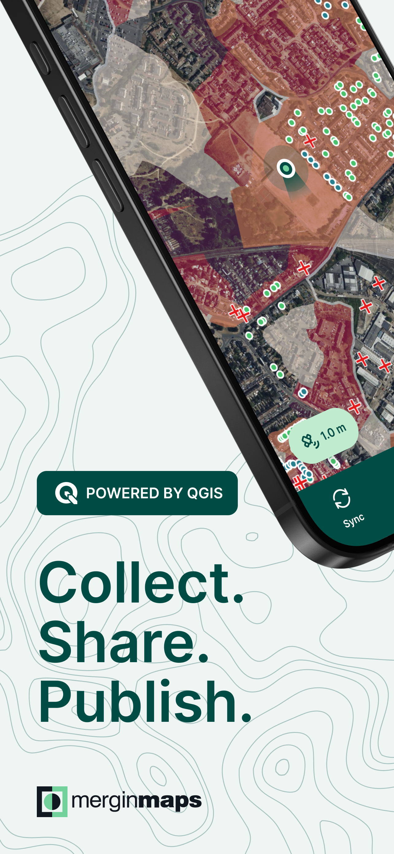


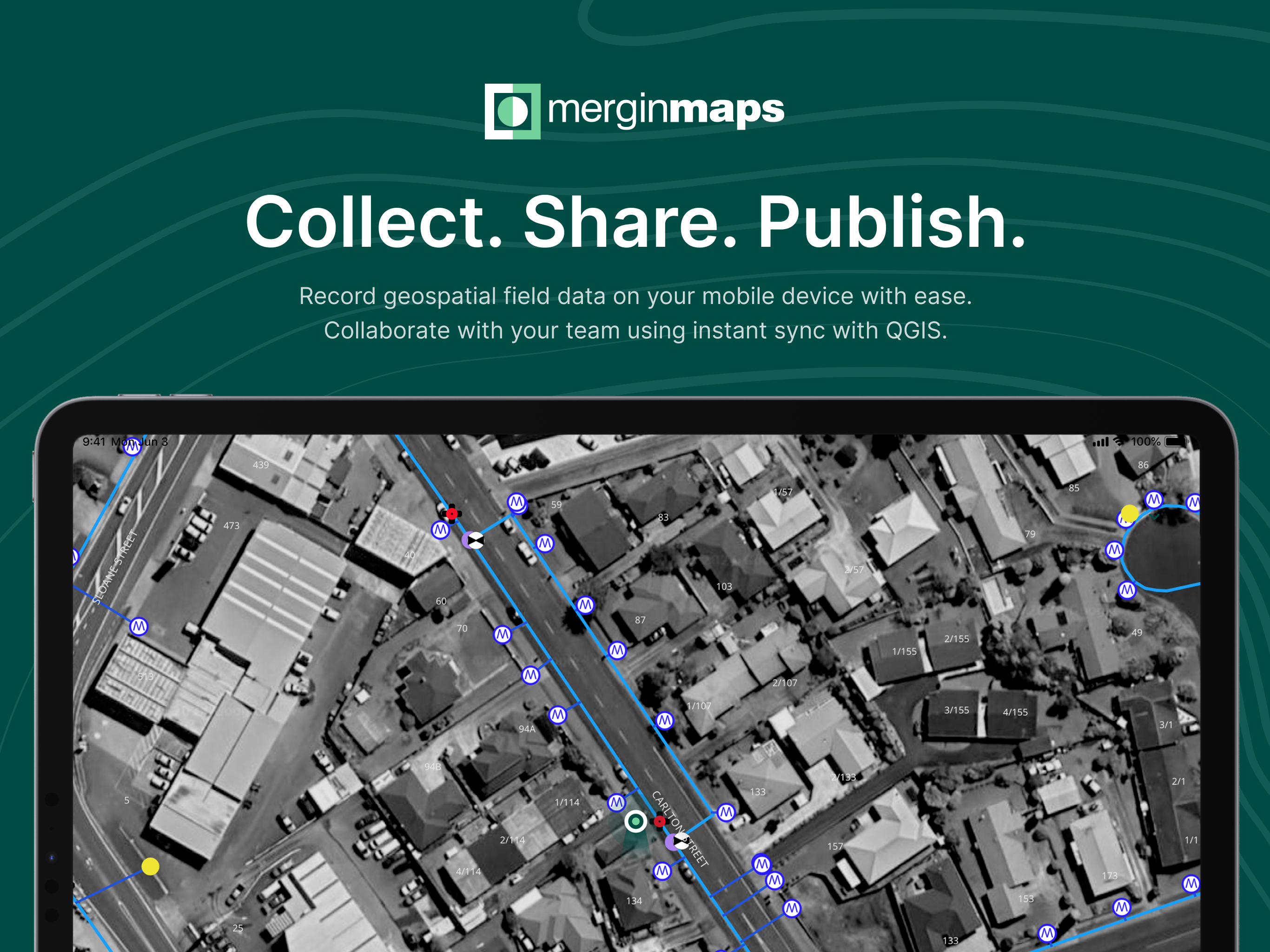


Features & Capabilities
User Growth & Download Statistics
App
- By:
- Lutra Consulting
- Rating:
- 3.70 (18)

- Version:
- 2026.2.0 Last updated: 2026-04-24
- Version code:
- 884859871
- Creation date:
- 2019-11-16
- Compatible devices:
- Size:
- 133.56MB
- URLs:
- Website ,Privacy policy
- Full description:
- See detailed description
- Source:
- Apple Apps Store
- Data ingested on:
- 2026-07-11
- Compare stats and ranking:
- Mergin Maps: QGIS in pocket vs Mapit GIS
- Mergin Maps: QGIS in pocket vs GeoCollect: GIS & Field Maps
- Mergin Maps: QGIS in pocket vs GK Field Mapper
Ranking
For Developers
Contact the developer
Chrome-Stats does not own this Apple app. Please use these information below to contact the Apple app developer.
User Reviews
Open maps is the only app worse than this one. Cannot use this without downloading maps to your phone to explore. I don’t trust that. I have worked with maps for many many years. Another person mentioned QField if they had a better menu I would not look for any other app. At this point HuntStand beats many so called map apps. This one seems useless unless you make another account just to try an apps potential. Other people say it needs work and I could not get far enough past bad ideas to try any functions. You have a menu so that’s the only reason this is not the worst.
by Wi*****, 2025-11-17
I have been using Mergin Maps for an academic research project and it has been a blessing. It’s made it so easy to collect field data from my phone and sync with my QGIS file at home. Customer support has also been very prompt and helpful when I had issues with my payment plan. Recommend!
by mm*****, 2024-09-27
Our volunteer organization has used Mergin Maps for two years. Our team of approximately 40 citizen scientists use the app to monitor about 200 nest boxes for a bird species whose numbers are in decline. We record a variety of variables regarding fledging success throughout the breeding season. This app has revolutionized our ability to monitor the birds in near-real time. Simply put, we could not keep up with the field data workload without this app! The wide variety of tools and options at our fingertips is more than we could’ve ever hoped for, and it’s integration with QGIS is seamless. I’ve used a number of field recording devices over the years, and Mergin Maps is equal to or better than any of
them, and when the free price of QGIS is factored in, this app is a tremendous bargain.
by St*****, 2024-02-01
Best Mergin Maps: QGIS in pocket Alternatives
Here are some Apple apps that are similar to Mergin Maps: QGIS in pocket:
Mapit GIS
Andrzej Bieniek
5.00  (1)
(1)
GeoCollect: GIS & Field Maps
Above AS
5.00 (3)

GK Field Mapper
GK Technology, Inc.
5.00 (2)

MGC: Mobile Geo Collector
Riska Arini
0.00 (0)

EKM Maps
EKM Global Consulting GmbH
0.00 (0)
Mobile Data Collection
GIS Cloud Inc.
4.80 (41)

QField for QGIS
OPENGIS.ch
4.10 (32)

Global Mapper Mobile
Blue Marble Geographics
3.70 (15)

K-Capture
K-MATIC
5.00 (1)

SW Maps
Aviyaan Tech
3.80 (24)

Felt: Field App, Maps, GIS
Felt
5.00 (5)

Touch GIS
TouchGIS
4.00 (32)