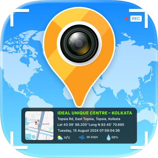
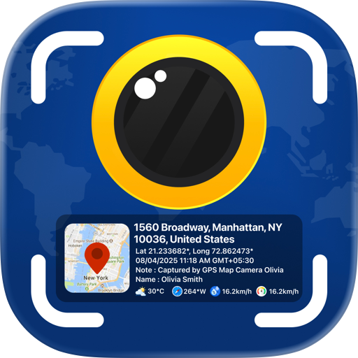
GPS Map Camera : Geotag Photos
Timestamp Camera for Travel
Overview
Features & Capabilities
User Growth & Download Statistics
- By:
- SHELL INFRASTRUCTURE PRIVATE LIMITED
- Rating:
- 4.30 (705)

- Version:
- 4.4 Last updated: 2026-06-23
- Version code:
- 887333380
- Creation date:
- 2019-04-29
- Compatible devices:
- Size:
- 50.57MB
- URLs:
- Website ,Privacy policy
- Full description:
- See detailed description
- Source:
- Apple Apps Store
- Data ingested on:
- 2026-07-19
- Compare stats and ranking:
- GPS Map Camera : Geotag Photos vs GPS Camera Photo By Location
- GPS Map Camera : Geotag Photos vs GeoScope - GPS Map Camera
- GPS Map Camera : Geotag Photos vs GPS Map Camera - Timestamp
Ranking
For Developers
Contact the developer
Chrome-Stats does not own this Apple app. Please use these information below to contact the Apple app developer.
User Reviews
Doesn’t take the location metadata from iPhone for a previous pic. Kinda useless for old photos. Good only for new pics
by R2*****, 2025-06-27
Zaneh Marie Garvin
by Za*****, 2024-02-11
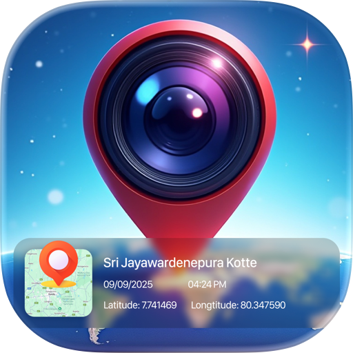
Best GPS Map Camera : Geotag Photos Alternatives
Here are some Apple apps that are similar to GPS Map Camera : Geotag Photos:

GPS Camera Photo By Location
Camera Map
0.00  (0)
(0)
GeoScope - GPS Map Camera
Bhaskar Rao
0.00 (0)
GPS Map Camera - Timestamp
Jatin Maniya
4.60 (171)

Geotag: GPS Timestamp Camera
Nhan Nguyen Thi
0.00 (0)

GPS Map Camera - Geo Timestamp
Romin Bhadani
0.00 (0)

GPS Map Camera – Time Stamp
Yash Baraiya
4.60 (182)
GPS Map Camera & GeoTag
Awan Junction
0.00 (0)
GPS Camera: Map & Geotag Photo
LAMMA TECH COMPANY LIMITED
5.00 (1)
GPS Map Camera Timestamp
Ankit Dhola
0.00 (0)

GPS Map Camera : Timestamp Cam
MILANKUMAR HIMMATBHAI KACHHADIYA
0.00 (0)

GPS Map Camera Geotag Location
Nikhil Viradiya
4.60 (143)
GPS Map Camera - Geotag Photo
Sejalben Nimeshkumar Savaliya
4.60 (15)